
- Start >
- Rivers >
- Waterlevel >
- Oberer Main - Elbe >
- Bad Berneck >
- Chart of month

Chart of month Bad Berneck / Weißer Main
Waterlevel from 28.01.2022 to 27.02.2022
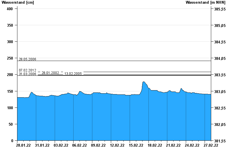
- 28.05.2006 Wasserstand: 242 cm
- 07.02.2012 Wasserstand: 208 cm
- 28.01.2002 Wasserstand: 200 cm
- 13.02.2005 Wasserstand: 198 cm
- 31.03.2006 Wasserstand: 197 cm
| Date | Waterlevel [cm] |
|---|---|
| 27.02.2022 23:45 | 140 |
| 27.02.2022 23:30 | 140 |
| 27.02.2022 23:15 | 139 |
| 27.02.2022 23:00 | 139 |
| 27.02.2022 22:45 | 139 |
| 27.02.2022 22:30 | 140 |
| 27.02.2022 22:15 | 140 |
© Bayerisches Landesamt für Umwelt 2024