
- Start >
- Rivers >
- Waterlevel >
- Oberer Main - Elbe >
- Autenhausen >
- Chart of month

Chart of month Autenhausen / Kreck
Waterlevel from 23.08.2021 to 22.09.2021
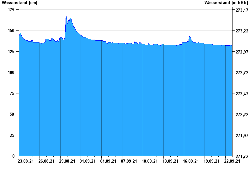
- Hochwassergefahrenfläche HQ100 370 cm
| Date | Waterlevel [cm] |
|---|---|
| 23.09.2021 00:45 | 132 |
| 23.09.2021 00:30 | 132 |
| 23.09.2021 00:15 | 133 |
| 23.09.2021 00:00 | 132 |
| 22.09.2021 23:45 | 133 |
| 22.09.2021 23:30 | 133 |
| 22.09.2021 23:15 | 132 |
© Bayerisches Landesamt für Umwelt 2024