
- Start >
- Rivers >
- Waterlevel >
- Oberer Main - Elbe >
- Aeschach >
- Chart of month

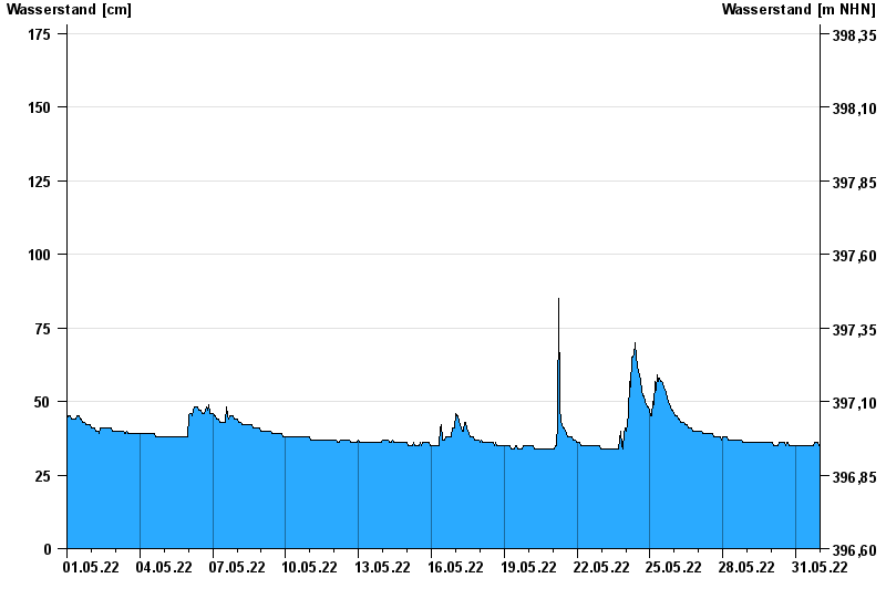
Chart of month Aeschach / Oberreitnauer Ach
Waterlevel from 01.05.2022 to 31.05.2022
- 02.06.2013 Wasserstand: 285 cm
- 22.07.2014 Wasserstand: 232 cm
- 27.07.2014 Wasserstand: 206 cm
- 17.06.2016 Wasserstand: 205 cm
- 19.06.2016 Wasserstand: 198 cm
| Date | Waterlevel [cm] |
|---|---|
| 01.06.2022 00:45 | 35 |
| 01.06.2022 00:30 | 35 |
| 01.06.2022 00:15 | 35 |
| 01.06.2022 00:00 | 35 |
| 31.05.2022 23:45 | 35 |
| 31.05.2022 23:30 | 35 |
| 31.05.2022 23:15 | 35 |
© Bayerisches Landesamt für Umwelt 2024