
- Start >
- Rivers >
- Waterlevel >
- Bayern >
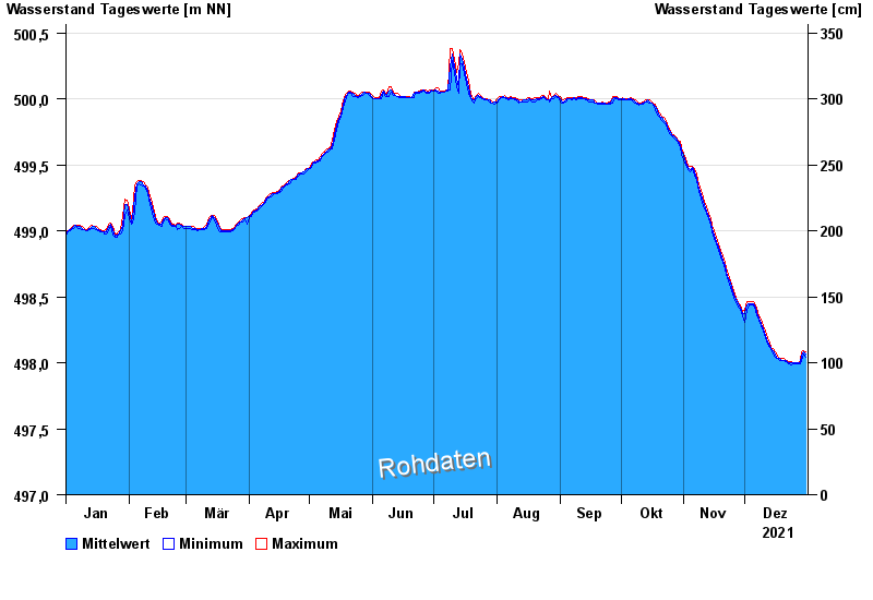
- Untreusee Seepegel >
- Chart of year

Chart of year Untreusee Seepegel / Untreusee
Waterlevel from 01.01.2021 to 31.12.2021
Linien: keine | Hauptwerte | Meldestufen | mittlerer Seespiegel | Hochwassermarken | historische Ereignisse
| Date | Mean value [cm] | Maximum [cm] | Minimum [cm] |
|---|---|---|---|
| 31.12.2021 | 498.07 | 498.08 | 498.04 |
| 30.12.2021 | 498.08 | 498.09 | 498.07 |
| 29.12.2021 | 498.06 | 498.08 | 498.02 |
| 28.12.2021 | 498.00 | 498.02 | 497.99 |
| 27.12.2021 | 498.00 | 498.00 | 497.99 |
| 26.12.2021 | 498.00 | 498.00 | 497.99 |
| 25.12.2021 | 498.00 | 498.00 | 497.99 |
© Bayerisches Landesamt für Umwelt 2024