
- Start >
- Rivers >
- Waterlevel >
- Bayern >
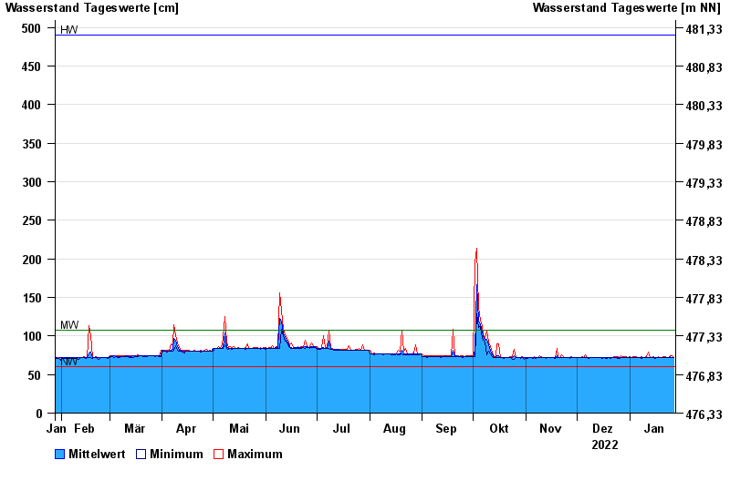
- Trostberg >
- Chart of year

Chart of year Trostberg / Alz
Waterlevel from 28.01.2022 to 27.01.2023
| Date | Mean value [cm] | Maximum [cm] | Minimum [cm] |
|---|---|---|---|
| 27.01.2023 | 72 | 72 | 72 |
| 26.01.2023 | 72 | 75 | 72 |
| 25.01.2023 | 73 | 75 | 72 |
| 24.01.2023 | 72 | 72 | 72 |
| 23.01.2023 | 72 | 72 | 72 |
| 22.01.2023 | 72 | 73 | 72 |
| 21.01.2023 | 72 | 73 | 72 |
© Bayerisches Landesamt für Umwelt 2024