
- Start >
- Rivers >
- Waterlevel >
- Bayern >
- Schönbrunn >
- Chart of year

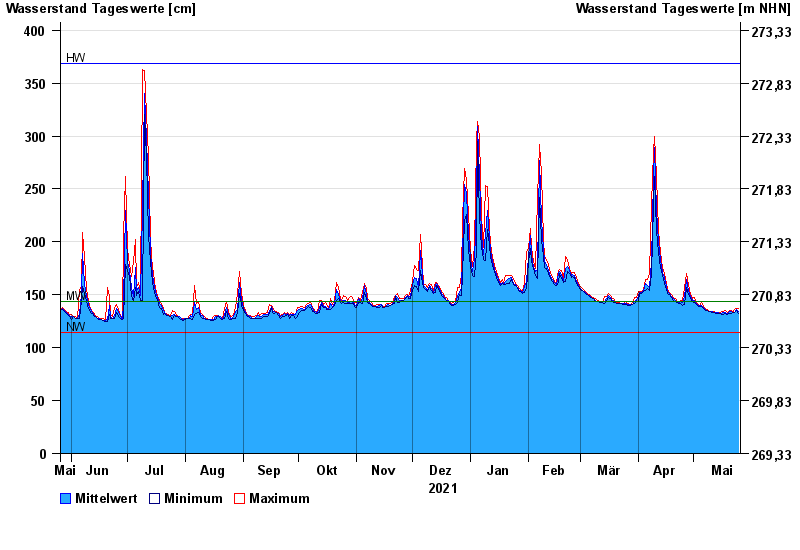
Chart of year Schönbrunn / Rauhe Ebrach
Waterlevel from 26.05.2021 to 25.05.2022
note
Beeinflussung des Abflusses aufgrund Hindernisse im Unterlauf
| Date | Mean value [cm] | Maximum [cm] | Minimum [cm] |
|---|---|---|---|
| 25.05.2022 | 134 | 137 | 132 |
| 24.05.2022 | 136 | 137 | 135 |
| 23.05.2022 | 133 | 136 | 133 |
| 22.05.2022 | 133 | 134 | 133 |
| 21.05.2022 | 134 | 135 | 132 |
| 20.05.2022 | 134 | 135 | 132 |
| 19.05.2022 | 132 | 133 | 131 |
© Bayerisches Landesamt für Umwelt 2024