
- Start >
- Rivers >
- Waterlevel >
- Bayern >
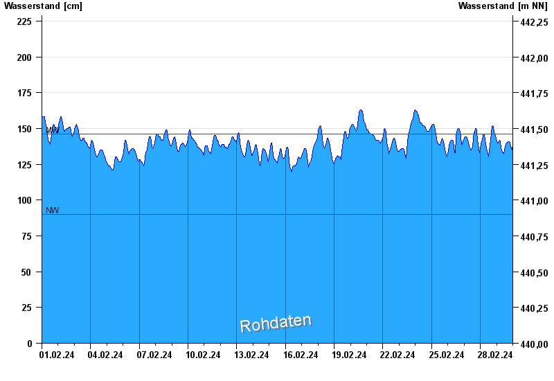
- Rosenheim u.d. Mangfallmündung >
- Chart of month

Chart of month Rosenheim u.d. Mangfallmündung / Inn
Waterlevel from 01.02.2024 to 29.02.2024
| Date | Waterlevel [cm] |
|---|---|
| 29.02.2024 23:45 | 139 |
| 29.02.2024 23:30 | 137 |
| 29.02.2024 23:15 | 135 |
| 29.02.2024 23:00 | 134 |
| 29.02.2024 22:45 | 133 |
| 29.02.2024 22:30 | 133 |
| 29.02.2024 22:15 | 134 |
© Bayerisches Landesamt für Umwelt 2024