
- Start >
- Rivers >
- Waterlevel >
- Bayern >
- Landau >
- Chart of year

Chart of year Landau / Isar
Waterlevel from 30.11.2022 to 29.11.2023
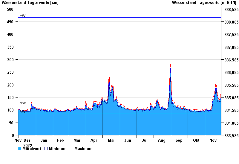
| Date | Mean value [cm] | Maximum [cm] | Minimum [cm] |
|---|---|---|---|
| 29.11.2023 | 147 | 163 | 135 |
| 28.11.2023 | 136 | 142 | 132 |
| 27.11.2023 | 137 | 143 | 134 |
| 26.11.2023 | 137 | 139 | 135 |
| 25.11.2023 | 139 | 144 | 135 |
| 24.11.2023 | 144 | 151 | 136 |
| 23.11.2023 | 152 | 164 | 134 |
© Bayerisches Landesamt für Umwelt 2024