
- Start >
- Rivers >
- Waterlevel >
- Bayern >
- Hüttendorf >
- Chart of year

Chart of year Hüttendorf / Regnitz
Waterlevel from 01.01.2023 to 31.12.2023
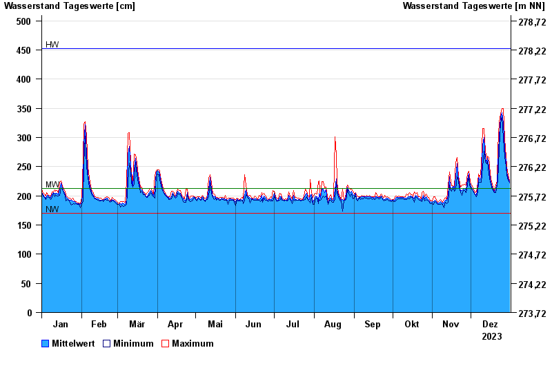
| Date | Mean value [cm] | Maximum [cm] | Minimum [cm] |
|---|---|---|---|
| 31.12.2023 | 224 | 227 | 222 |
| 30.12.2023 | 230 | 235 | 227 |
| 29.12.2023 | 241 | 250 | 235 |
| 28.12.2023 | 259 | 267 | 250 |
| 27.12.2023 | 280 | 298 | 267 |
| 26.12.2023 | 324 | 350 | 298 |
| 25.12.2023 | 342 | 350 | 335 |
© Bayerisches Landesamt für Umwelt 2024