
- Start >
- Rivers >
- Waterlevel >
- Bayern >
- Eschelbach >
- Chart of year

Chart of year Eschelbach / Inn
Waterlevel from 17.04.2024 to 16.04.2025
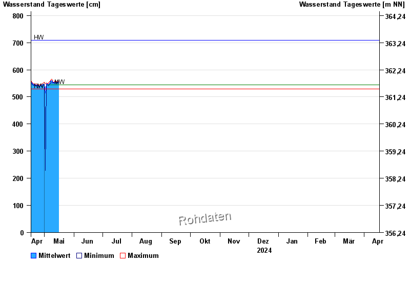
| Date | Mean value [cm] | Maximum [cm] | Minimum [cm] |
|---|---|---|---|
| 27.07.2024 | 562 | 565 | 558 |
| 26.07.2024 | 565 | 570 | 562 |
| 25.07.2024 | 569 | 572 | 563 |
| 24.07.2024 | 570 | 578 | 565 |
| 23.07.2024 | 571 | 577 | 566 |
| 22.07.2024 | 570 | 578 | 563 |
| 21.07.2024 | 566 | 571 | 560 |
© Bayerisches Landesamt für Umwelt 2024