
- Start >
- Rivers >
- Waterlevel >
- Bayern >
- Böhmischbruck >
- Chart of year

Chart of year Böhmischbruck / Pfreimd
Waterlevel from 01.01.2023 to 31.12.2023
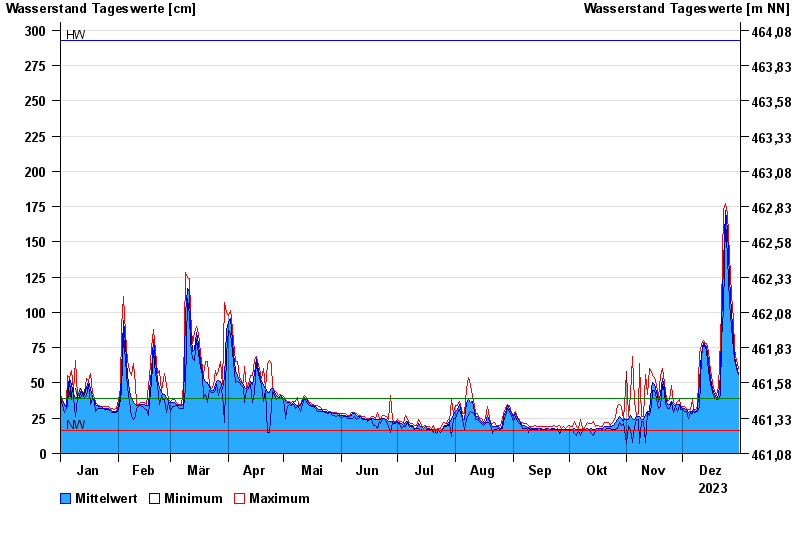
| Date | Mean value [cm] | Maximum [cm] | Minimum [cm] |
|---|---|---|---|
| 31.12.2023 | 57 | 60 | 56 |
| 30.12.2023 | 62 | 66 | 60 |
| 29.12.2023 | 69 | 74 | 66 |
| 28.12.2023 | 81 | 95 | 74 |
| 27.12.2023 | 100 | 112 | 89 |
| 26.12.2023 | 124 | 140 | 107 |
| 25.12.2023 | 158 | 170 | 139 |
© Bayerisches Landesamt für Umwelt 2024