
- Start >
- Rivers >
- Discharge >
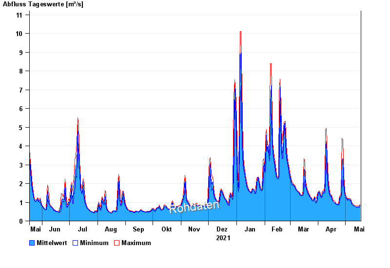
- Naab - Regen >
- Pfrentsch >
- Chart of year

Chart of year Pfrentsch / Pfreimd
Discharge from 18.05.2021 to 17.05.2022
| Date | Mean value [m³/s] | Maximum [m³/s] | Minimum [m³/s] |
|---|---|---|---|
| 17.05.2022 | 0.834 | 0.892 | 0.794 |
| 16.05.2022 | 0.741 | 0.794 | 0.701 |
| 15.05.2022 | 0.753 | 0.794 | 0.747 |
| 14.05.2022 | 0.755 | 0.794 | 0.747 |
| 13.05.2022 | 0.745 | 0.794 | 0.701 |
| 12.05.2022 | 0.763 | 0.794 | 0.747 |
| 11.05.2022 | 0.807 | 0.843 | 0.794 |
© Bayerisches Landesamt für Umwelt 2024