
- Start >
- Rivers >
- Discharge >
- Isar >
- Oberammergau >
- Chart of year

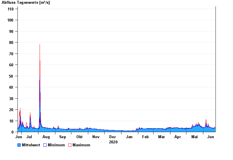
Chart of year Oberammergau / Ammer
Discharge from 24.06.2020 to 23.06.2021
- 23.08.2005 Abfluss: 181 m³/s
- 22.05.1999 Abfluss: 168 m³/s
- 23.07.1966 Abfluss: 135 m³/s
- 14.06.1959 Abfluss: 126 m³/s
- 12.08.2002 Abfluss: 125 m³/s
| Date | Mean value [m³/s] | Maximum [m³/s] | Minimum [m³/s] |
|---|---|---|---|
| 23.06.2021 | 3.8 | 4.49 | 3.59 |
| 22.06.2021 | 3.51 | 4.49 | 3.18 |
| 21.06.2021 | 3.38 | 3.38 | 3.38 |
| 20.06.2021 | 3.38 | 3.38 | 3.38 |
| 19.06.2021 | 3.44 | 3.59 | 3.18 |
| 18.06.2021 | 3.58 | 3.59 | 3.38 |
| 17.06.2021 | 3.59 | 3.59 | 3.59 |
© Bayerisches Landesamt für Umwelt 2024