
- Start >
- Rivers >
- Discharge >
- Bayern >
- Vilsbiburg >
- Master data

Master data Vilsbiburg
Site number: 17215007
Community: Vilsbiburg
District: Landshut
Operator:  Wasserwirtschaftsamt Landshut
Body of water: Große Vils
Catchment: 320.30 km2
River chainage: 86.79 km
Easting: 748836 (ETRS89 / UTM Zone 32N)
Northing: 5372149
Gauge zero point: 435.76 m NHN (DHHN2016)
Picture of the measurement site
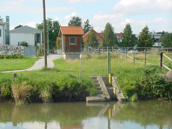
Location of the station Vilsbiburg / Große Vils
| Measurement site | Category |
|---|---|
 Landshut Birket Landshut Birket | Rivers: Runoff, Waterlevel, Water temperature, Water temperature, Suspended sediment |
| Landshut (virtuell) | Rivers: Runoff |
| Landshut Flutmulde | Rivers: Runoff, Waterlevel |
| Aham | Rivers: Runoff, Waterlevel |
© Bayerisches Landesamt für Umwelt 2026