
- Start >
- Rivers >
- Discharge >
- Bayern >
- Rosenheim o.d. Mangfallmündung >
- Chart of year

Chart of year Rosenheim o.d. Mangfallmündung / Inn
Discharge from 01.01.2024 to 30.04.2024
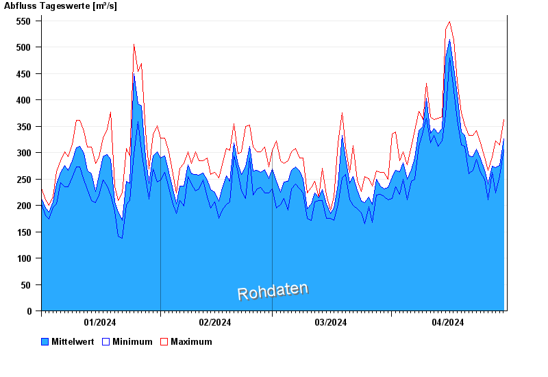
| Date | Mean value [m³/s] | Maximum [m³/s] | Minimum [m³/s] |
|---|---|---|---|
| 30.04.2024 | 311 | 318 | 305 |
| 29.04.2024 | 276 | 315 | 256 |
| 28.04.2024 | 271 | 322 | 224 |
| 27.04.2024 | 274 | 291 | 263 |
| 26.04.2024 | 240 | 267 | 210 |
| 25.04.2024 | 267 | 291 | 249 |
| 24.04.2024 | 288 | 318 | 263 |
© Bayerisches Landesamt für Umwelt 2024