

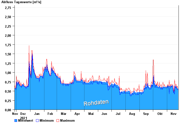
Chart of year Bärenthal / Trubach
Discharge from 27.11.2021 to 26.11.2022
note
Absinken des Wasserstandes wegen Entfernung von Auflandungen.
- 01.03.1956 Abfluss: 12 m³/s
- 01.02.1950 Abfluss: 7,4 m³/s
- 01.03.1955 Abfluss: 5,2 m³/s
- 22.12.1991 Abfluss: 3,48 m³/s
- 20.07.2011 Abfluss: 3,42 m³/s
| Date | Mean value [m³/s] | Maximum [m³/s] | Minimum [m³/s] |
|---|---|---|---|
| 26.11.2022 | 0.538 | 0.538 | 0.538 |
| 25.11.2022 | 0.565 | 0.587 | 0.538 |
| 24.11.2022 | 0.574 | 0.636 | 0.538 |
| 23.11.2022 | 0.576 | 0.587 | 0.538 |
| 22.11.2022 | 0.612 | 0.636 | 0.587 |
| 21.11.2022 | 0.63 | 0.69 | 0.587 |
| 20.11.2022 | 0.594 | 0.636 | 0.587 |
© Bayerisches Landesamt für Umwelt 2024