
- Start >
- Rivers >
- Biology >
- Unterer Main >
- Erlabrunn KW-OW >
- Master data

Master data Erlabrunn KW-OW
Site number: 20256
Community: Erlabrunn
District: Würzburg
Operator: WWA Aschaffenburg
Body of water: Main
Catchment: 14.244.00 km2
Easting: 561436 (ETRS89 / UTM Zone 32N)
Northing: 5522846
- summary measurement sites
- state measurement sites
 extended master data - (PDF)
Picture of the measurement site
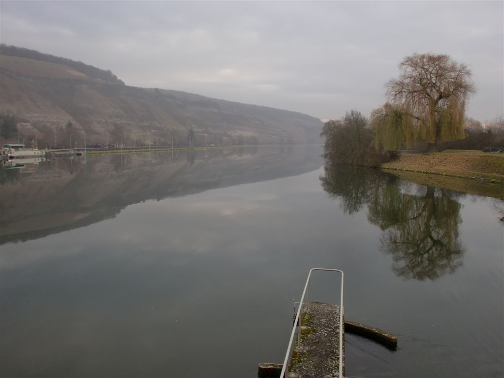
Location of the station Erlabrunn KW-OW / Main
| Measurement site | Category |
|---|---|
| Würzburg | Rivers: Runoff, Waterlevel, Water temperature, Water temperature |
| Würzburg Q | Rivers: Runoff |
| Würzburg | Rivers: Runoff, Waterlevel |
| Arnstein | Rivers: Runoff, Waterlevel, Water temperature, Water temperature |
| Sachsenheim | Rivers: Runoff, Waterlevel, Water temperature, Water temperature |
| Wolfsmünster | Rivers: Runoff, Waterlevel, Water temperature, Water temperature, Suspended sediment |
| Gemünden Lachsfangsteg | Rivers: Runoff, Waterlevel |
| Wüstenzell | Rivers: Runoff, Waterlevel |
| Erlabrunn Messstation | Rivers: Water temperature, Water temperature |
| Erlabrunn KW-OW | Rivers: Chemistry, Biology |
| Gemünden oh. Sinnmündung | Rivers: Chemistry, Biology |
| km 15,8 oh Maidbronn | Rivers: Chemistry, Biology |
| Brücke am Trieb beim roten Kreuz | Rivers: Chemistry, Biology |
| Strbr. Höhe Äußerer Bürgergraben | Rivers: Chemistry, Biology |
| km 0,09 oh Mündung | Rivers: Chemistry |
| Gemünden Wegbrücke | Rivers: Chemistry, Biology |
| Strbr. uh Badesee | Rivers: Chemistry, Biology |
| km 2,85 uh KA Karbach | Rivers: Chemistry, Biology |
| km 11,79 Br. Holzmühle | Rivers: Chemistry, Biology |
| uh KA Helmstadt_Holzkirchhausen | Rivers: Chemistry, Biology |
| oh Landesgrenze | Rivers: Chemistry, Biology |
| km 1,7 uh Pegel Europastern | Rivers: Chemistry, Biology |
| Steg Wendeplatz "Am Heigelsbach" | Rivers: Chemistry, Biology |
| SH Eichel km 171,35 Trennfeld Fahrgasse | Rivers: Chemistry |
| km 1,85 Pegel Sachsenheim | Rivers: Chemistry |
| km 5,54 Glascont.Ach. | Rivers: Chemistry |
| Straßenbrücke Mühlhausen | Rivers: Chemistry |
| Zeuzleben, Pegel | Rivers: Chemistry |
| km 6,8 uh Gaukönigshofen | Rivers: Chemistry, Biology |
| Messstation Erlabrunn | Rivers: Chemistry |
| Kaisten | Rivers: Chemistry |
| km 13,3 uh Ft Schönarts | Rivers: Biology |
| km 15,8 oh Uettingen | Rivers: Biology |
| Reichthalshof MU4 | Groundwater: Upper groundwater layer |
| ROTHOF (WÜ-MU 8) | Groundwater: Deep groundwater layer |
| Zeubelried (WÜ-MU 7) | Groundwater: Deep groundwater layer |
| Stadtwald / Würzburg (WÜ- MU 4) | Groundwater: Upper groundwater layer |
| Birkenfeld WÜ - MU 1 | Groundwater: Upper groundwater layer |
| Büchold MU 13 | Groundwater: Deep groundwater layer |
| Dreibrunnenquelle | Groundwater: Flow of well |
| RIENECK 164 | Groundwater: Upper groundwater layer |
| Leinach MU 2 | Groundwater: Deep groundwater layer |
| Hausen MU-11 (Keuper) | Groundwater: Upper groundwater layer |
| Waldzell S 2 | Groundwater: Deep groundwater layer |
| Massenbuch S 3 | Groundwater: Upper groundwater layer |
| Fuchsstadt Mu3 | Groundwater: Deep groundwater layer |
| Goßmannsdorf a. Main WÜ | Groundwater: Upper groundwater layer |
| Güntersleben | Groundwater: Upper groundwater layer |
| OBERPLEICHFELD (9) | Groundwater: Deep groundwater layer |
| Kist MU 3 | Groundwater: Upper groundwater layer |
| Wasserlosen Muschelkalk 1 | Groundwater: Upper groundwater layer |
| Altbessingen A01 | Groundwater: Upper groundwater layer |
| 1131602600035 | Groundwater: Chemistry |
| 4110592400004 | Groundwater: Chemistry |
| 4110592400009 | Groundwater: Chemistry |
| 4110592500001 | Groundwater: Chemistry |
| 4110602400049 | Groundwater: Chemistry |
| 4110602500038 | Groundwater: Chemistry |
| 4110612400001 | Groundwater: Chemistry |
| 4110612400005 | Groundwater: Chemistry |
| 4110612500004 | Groundwater: Chemistry |
| 4110622600001 | Groundwater: Chemistry |
| 4120592300023 | Groundwater: Chemistry |
| 4120602400057 | Groundwater: Chemistry |
| 4120602500012 | Groundwater: Chemistry |
| 4120602600009 | Groundwater: Chemistry |
| 4120602600010 | Groundwater: Chemistry |
| 4120612500010 | Groundwater: Chemistry |
| 4120612500012 | Groundwater: Chemistry |
| 4120622300012 | Groundwater: Chemistry |
| 4120632500007 | Groundwater: Chemistry |
| 4120632500008 | Groundwater: Chemistry |
| 4110602600053 | Groundwater: Chemistry |
| 1131632600005 | Groundwater: Chemistry |
| 4110622400012 | Groundwater: Chemistry |
| 4120612400013 | Groundwater: Chemistry |
| 4110622400008 | Groundwater: Chemistry |
| 4110592600021 | Groundwater: Chemistry |
| 1131582600067 | Groundwater: Chemistry |
| 1132612300055 | Groundwater: Chemistry |
| 1132622400034 | Groundwater: Chemistry |
| 1132632500073 | Groundwater: Chemistry |
| 1131612400104 | Groundwater: Chemistry |
| 1131612600053 | Groundwater: Chemistry |
| 1131592600055 | Groundwater: Chemistry |
| 1131612600056 | Groundwater: Chemistry |
| 1132632500080 | Groundwater: Chemistry |
| 1132612400159 | Groundwater: Chemistry |
| 1132602400227 | Groundwater: Chemistry |
| 1132622400036 | Groundwater: Chemistry |
| 1131612600054 | Groundwater: Chemistry |
| 4120602400058 | Groundwater: Chemistry |
| 1132622400108 | Groundwater: Chemistry |
| 1131592400173 | Groundwater: Chemistry |
| 4120602300029 | Groundwater: Chemistry |
| 1131612300128 | Groundwater: Chemistry |
| 1131592600114 | Groundwater: Chemistry |
| 1131592500031 | Groundwater: Chemistry |
| Seligenstadt | Meteorology: Precipitation, Wind, Air temperatur, Air moisture, Global radiation |
| Randersacker | Meteorology: Precipitation, Wind, Air temperatur, Air moisture, Global radiation |
| Euerhausen | Meteorology: Precipitation, Wind, Air temperatur, Air moisture, Global radiation |
| Steinfeld | Meteorology: Precipitation, Wind, Air temperatur, Air moisture, Global radiation |
| Gerbrunn | Meteorology: Precipitation, Wind, Global radiation |
| Helmstadt | Meteorology: Precipitation, Wind, Air temperatur, Air moisture, Global radiation |
| Veitshöchheim | Meteorology: Precipitation, Wind, Air temperatur, Air moisture, Global radiation |
| Marktheidenfeld | Meteorology: Precipitation, Wind, Air temperatur, Air moisture, Global radiation |
| Würzburg-Stein | Meteorology: Wind, Air temperatur, Air moisture, Global radiation |
© Bayerisches Landesamt für Umwelt 2026