
- Start >
- Lakes >
- Waterlevel >
- Bayern >
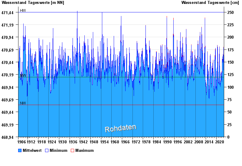
- Krottenmühl >
- Chart of total period

Chart of total period Krottenmühl / Simssee
Waterlevel from 01.09.1906 to 26.04.2024
Linien: keine | Hauptwerte | Meldestufen | mittlerer Seespiegel | Hochwassermarken | historische Ereignisse
| Date | Mean value [m above sealevel] | Maximum [m above sealevel] | Minimum [m above sealevel] |
|---|---|---|---|
| 26.04.2024 | 470.15 | 470.16 | 470.15 |
| 25.04.2024 | 470.15 | 470.16 | 470.15 |
| 24.04.2024 | 470.15 | 470.16 | 470.14 |
| 23.04.2024 | 470.14 | 470.14 | 470.13 |
| 22.04.2024 | 470.13 | 470.13 | 470.12 |
| 21.04.2024 | 470.09 | 470.12 | 470.07 |
| 20.04.2024 | 470.06 | 470.07 | 470.05 |
© Bayerisches Landesamt für Umwelt 2024