
- Start >
- Groundwater >
- Waterlevel of upper layer >
- Regnitz >
- Wittelshofen >
- Chart of total period

Chart of total period Wittelshofen
Groundwater levels of the total period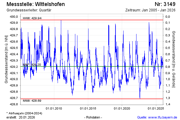
Groundwater level [m above sealevel]: 429.24
Distance to surface [m]: 0.76
Last value from 21.05.2024 13:00
Ground level [m above sealevel]: 430.00
| Date | Groundwater level [m above sealevel] |
|---|---|
| 20.05.2024 | 429.25 |
| 19.05.2024 | 429.27 |
| 18.05.2024 | 429.27 |
| 17.05.2024 | 429.24 |
| 16.05.2024 | 429.19 |
| 15.05.2024 | 429.19 |
| 14.05.2024 | 429.20 |
| 13.05.2024 | 429.20 |
© Bayerisches Landesamt für Umwelt 2024