
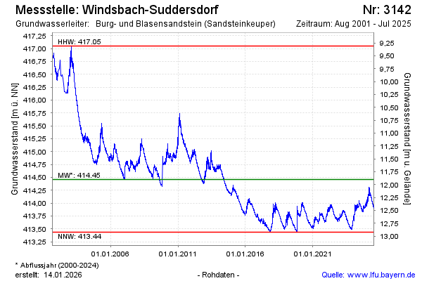
Chart of total period Windsbach-Suddersdorf
Groundwater level [m above sealevel]: 414,04
Distance to surface [m]: 12,32
Last value from 03.06.2026 12:18
Ground level [m above sealevel]: 426.36
| Date | Groundwater level [m above sealevel] |
|---|---|
| 03.06.2026 | 414.05 |
| 02.06.2026 | 414.06 |
| 01.06.2026 | 414.04 |
| 31.05.2026 | 414.05 |
| 30.05.2026 | 414.04 |
| 29.05.2026 | 414.03 |
| 28.05.2026 | 414.04 |
| 27.05.2026 | 414.05 |