
- Start >
- Groundwater >
- Waterlevel of upper layer >
- Regnitz >
- Wilburgstetten GM 5A F >
- Current data

Current data Wilburgstetten GM 5A F
Groundwater levels of the last 12 months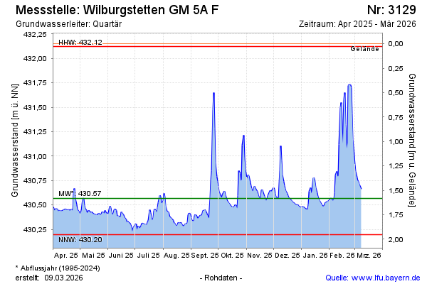
Groundwater level [m above sealevel]: 430.58
Distance to surface [m]: 1.57
Last value from 25.04.2024 13:00
Ground level [m above sealevel]: 432.15
| Date | Groundwater level [m above sealevel] |
|---|---|
| 25.04.2024 | 430.59 |
| 24.04.2024 | 430.61 |
| 23.04.2024 | 430.64 |
| 22.04.2024 | 430.67 |
| 21.04.2024 | 430.66 |
| 20.04.2024 | 430.63 |
| 19.04.2024 | 430.55 |
| 18.04.2024 | 430.56 |
© Bayerisches Landesamt für Umwelt 2024