
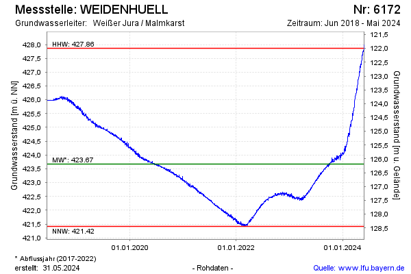
Chart of total period Weidenhuell
Groundwater level [m above sealevel]: 427.03
Distance to surface [m]: 122.83
Last value from 15.07.2026 10:00
Ground level [m above sealevel]: 549.86
| Date | Groundwater level [m above sealevel] |
|---|---|
| 15.07.2026 | 427.04 |
| 14.07.2026 | 427.06 |
| 13.07.2026 | 427.06 |
| 12.07.2026 | 427.04 |
| 11.07.2026 | 427.06 |
| 10.07.2026 | 427.09 |
| 09.07.2026 | 427.09 |
| 08.07.2026 | 427.11 |