
- Start >
- Groundwater >
- Waterlevel of upper layer >
- Regnitz >
- WALD/A2-FLACHBR 762 >
- Chart of total period

Chart of total period WALD/A2-FLACHBR 762
Groundwater levels of the total period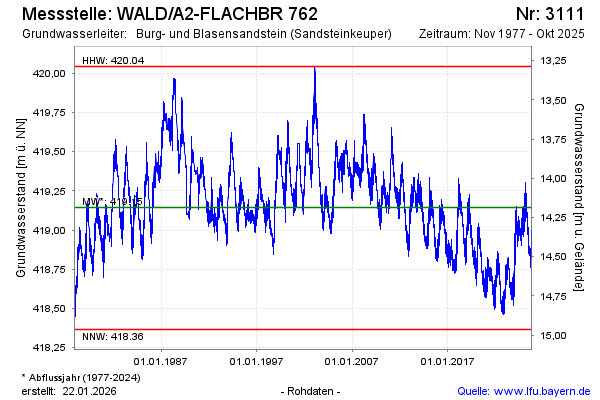
Groundwater level [m above sealevel]: 418.82
Distance to surface [m]: 14.51
Last value from 25.01.2024 11:26
Ground level [m above sealevel]: 433.33
| Date | Groundwater level [m above sealevel] |
|---|---|
| 25.01.2024 | 418.83 |
| 24.01.2024 | 418.85 |
| 23.01.2024 | 418.83 |
| 22.01.2024 | 418.84 |
| 21.01.2024 | 418.79 |
| 20.01.2024 | 418.78 |
| 19.01.2024 | 418.85 |
| 18.01.2024 | 418.98 |
© Bayerisches Landesamt für Umwelt 2024