
Current data STEGAURACH 236
Groundwater level [m above sealevel]: 257.51
Distance to surface [m]: 3.18
Last value from 24.06.2026 09:29
Ground level [m above sealevel]: 260.69
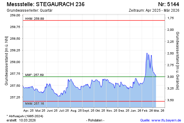
| Date | Groundwater level [m above sealevel] |
|---|---|
| 27.06.2026 | 257.39 |
| 26.06.2026 | 257.42 |
| 25.06.2026 | 257.44 |
| 24.06.2026 | 257.48 |
| 23.06.2026 | 257.50 |
| 22.06.2026 | 257.43 |
| 21.06.2026 | 257.35 |
| 20.06.2026 | 257.35 |