
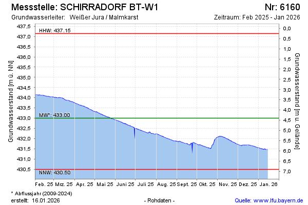
Current data SCHIRRADORF BT-W1
Groundwater level [m above sealevel]: 431.83
Distance to surface [m]: 5.57
Last value from 13.07.2026 10:00
Ground level [m above sealevel]: 437.40
| Date | Groundwater level [m above sealevel] |
|---|---|
| 13.07.2026 | 431.85 |
| 12.07.2026 | 431.86 |
| 11.07.2026 | 431.87 |
| 10.07.2026 | 431.89 |
| 09.07.2026 | 431.90 |
| 08.07.2026 | 431.92 |
| 07.07.2026 | 431.93 |
| 06.07.2026 | 431.94 |