
Chart of total period SACHSENDORF 187
Groundwater level [m above sealevel]: 407,71
Distance to surface [m]: 13,62
Last value from 23.07.2026 10:00
Ground level [m above sealevel]: 421.33
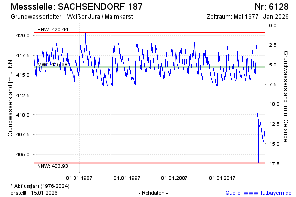
| Date | Groundwater level [m above sealevel] |
|---|---|
| 23.07.2026 | 407.72 |
| 22.07.2026 | 407.73 |
| 21.07.2026 | 407.74 |
| 20.07.2026 | 407.76 |
| 19.07.2026 | 407.78 |
| 18.07.2026 | 407.79 |
| 17.07.2026 | 407.81 |
| 16.07.2026 | 407.81 |