
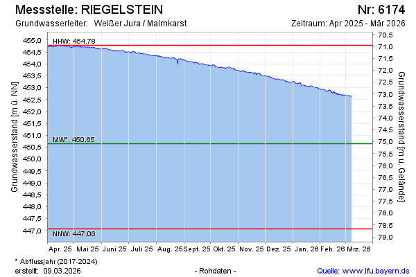
Current data RIEGELSTEIN
Groundwater level [m above sealevel]: 452.29
Distance to surface [m]: 73.44
Last value from 24.06.2026 10:00
Ground level [m above sealevel]: 525.73
| Date | Groundwater level [m above sealevel] |
|---|---|
| 24.06.2026 | 452.30 |
| 23.06.2026 | 452.30 |
| 22.06.2026 | 452.30 |
| 21.06.2026 | 452.29 |
| 20.06.2026 | 452.30 |
| 19.06.2026 | 452.32 |
| 18.06.2026 | 452.32 |
| 17.06.2026 | 452.33 |