
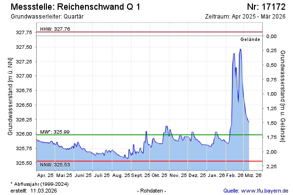
Current data Reichenschwand Q 1
Groundwater level [m above sealevel]: 325.60
Distance to surface [m]: 2.09
Last value from 13.07.2026 10:00
Ground level [m above sealevel]: 327.69
| Date | Groundwater level [m above sealevel] |
|---|---|
| 13.07.2026 | 325.59 |
| 12.07.2026 | 325.59 |
| 11.07.2026 | 325.60 |
| 10.07.2026 | 325.61 |
| 09.07.2026 | 325.62 |
| 08.07.2026 | 325.61 |
| 07.07.2026 | 325.62 |
| 06.07.2026 | 325.64 |