
- Start >
- Groundwater >
- Waterlevel of upper layer >
- Regnitz >
- Reichelsdorf Q 7 >
- Chart of total period

Chart of total period Reichelsdorf Q 7
Groundwater levels of the total period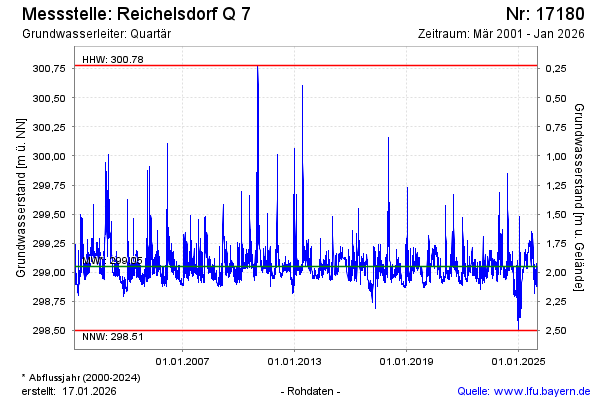
Groundwater level [m above sealevel]: 299.77
Distance to surface [m]: 1.23
Last value from 24.02.2026 10:15
Ground level [m above sealevel]: 301.00
| Date | Groundwater level [m above sealevel] |
|---|---|
| 24.02.2026 | 299.78 |
| 23.02.2026 | 299.83 |
| 22.02.2026 | 299.72 |
| 21.02.2026 | 299.47 |
| 20.02.2026 | 299.46 |
| 19.02.2026 | 299.62 |
| 18.02.2026 | 299.88 |
| 17.02.2026 | 299.67 |
© Bayerisches Landesamt für Umwelt 2026