
- Start >
- Groundwater >
- Waterlevel of upper layer >
- Regnitz >
- NORDL.OTTENBERG C 199 >
- Chart of total period

Chart of total period NORDL.OTTENBERG C 199
Groundwater levels of the total period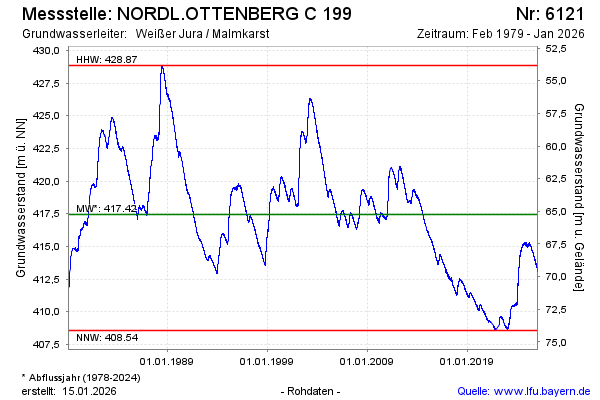
Groundwater level [m above sealevel]: 413.18
Distance to surface [m]: 69.50
Last value from 08.03.2026 09:00
Ground level [m above sealevel]: 482.68
| Date | Groundwater level [m above sealevel] |
|---|---|
| 08.03.2026 | 413.22 |
| 07.03.2026 | 413.20 |
| 06.03.2026 | 413.20 |
| 05.03.2026 | 413.18 |
| 04.03.2026 | 413.14 |
| 03.03.2026 | 413.12 |
| 02.03.2026 | 413.11 |
| 01.03.2026 | 413.08 |
© Bayerisches Landesamt für Umwelt 2026