
- Start >
- Groundwater >
- Waterlevel of upper layer >
- Regnitz >
- Mitteldachstetten-Dörflein >
- Current data

Current data Mitteldachstetten-Dörflein
Groundwater levels of the last 12 months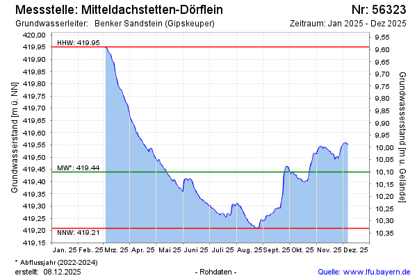
Groundwater level [m above sealevel]: 420.43
Distance to surface [m]: 9.11
Last value from 06.03.2026 13:00
Ground level [m above sealevel]: 429.54
| Date | Groundwater level [m above sealevel] |
|---|---|
| 06.03.2026 | 420.45 |
| 05.03.2026 | 420.48 |
| 04.03.2026 | 420.51 |
| 03.03.2026 | 420.56 |
| 02.03.2026 | 420.60 |
| 01.03.2026 | 420.64 |
| 28.02.2026 | 420.69 |
| 27.02.2026 | 420.71 |
© Bayerisches Landesamt für Umwelt 2026