
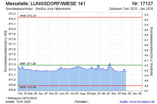
Current data LUNGSDORF/WIESE 141
Groundwater level [m above sealevel]: 371.15
Distance to surface [m]: 4.33
Last value from 22.06.2026 14:00
Ground level [m above sealevel]: 375.48
| Date | Groundwater level [m above sealevel] |
|---|---|
| 22.06.2026 | 371.14 |
| 21.06.2026 | 371.14 |
| 20.06.2026 | 371.14 |
| 19.06.2026 | 371.14 |
| 18.06.2026 | 371.14 |
| 17.06.2026 | 371.14 |
| 16.06.2026 | 371.15 |
| 15.06.2026 | 371.16 |