
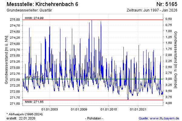
Chart of total period KIRCHEHRENBACH 6
Groundwater level [m above sealevel]: 272,10
Distance to surface [m]: 3,43
Last value from 21.07.2026 09:30
Ground level [m above sealevel]: 275.53
| Date | Groundwater level [m above sealevel] |
|---|---|
| 21.07.2026 | 272.09 |
| 20.07.2026 | 272.08 |
| 19.07.2026 | 272.07 |
| 18.07.2026 | 272.08 |
| 17.07.2026 | 272.09 |
| 16.07.2026 | 272.10 |
| 15.07.2026 | 272.11 |
| 14.07.2026 | 272.12 |