
- Start >
- Groundwater >
- Waterlevel of upper layer >
- Regnitz >
- Kersbach 21 >
- Chart of total period

Chart of total period Kersbach 21
Groundwater levels of the total period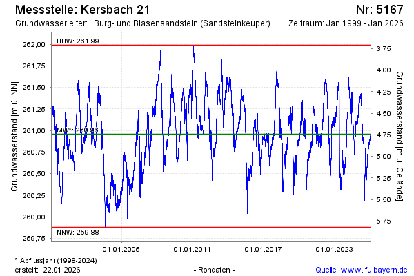
Groundwater level [m above sealevel]: 260.81
Distance to surface [m]: 4.89
Last value from 28.05.2026 10:00
Ground level [m above sealevel]: 265.70
| Date | Groundwater level [m above sealevel] |
|---|---|
| 28.05.2026 | 260.83 |
| 27.05.2026 | 260.86 |
| 26.05.2026 | 260.89 |
| 25.05.2026 | 260.91 |
| 24.05.2026 | 260.95 |
| 23.05.2026 | 261.00 |
| 22.05.2026 | 261.04 |
| 21.05.2026 | 261.06 |
© Bayerisches Landesamt für Umwelt 2026