
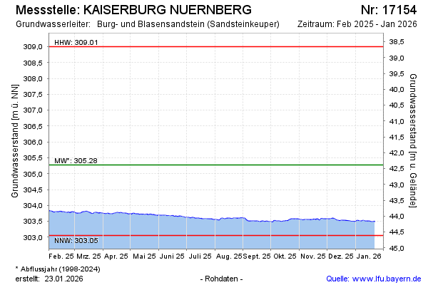
Current data KAISERBURG NUERNBERG
Groundwater level [m above sealevel]: 303.53
Distance to surface [m]: 44.13
Last value from 24.06.2026 10:00
Ground level [m above sealevel]: 347.66
| Date | Groundwater level [m above sealevel] |
|---|---|
| 28.06.2026 | 303.52 |
| 27.06.2026 | 303.52 |
| 26.06.2026 | 303.53 |
| 25.06.2026 | 303.53 |
| 24.06.2026 | 303.53 |
| 23.06.2026 | 303.52 |
| 22.06.2026 | 303.53 |
| 21.06.2026 | 303.53 |