
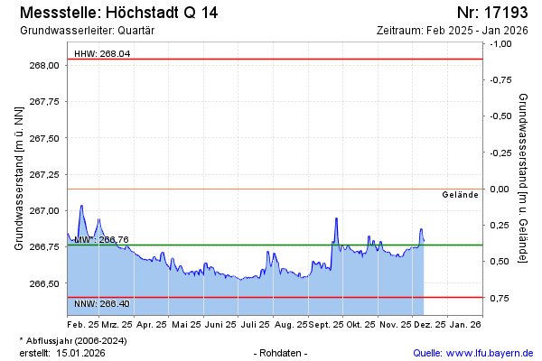
Current data Höchstadt Q 14
Groundwater level [m above sealevel]: 266.47
Distance to surface [m]: 0.67999999999995
Last value from 23.06.2026 13:06
Ground level [m above sealevel]: 267.15
| Date | Groundwater level [m above sealevel] |
|---|---|
| 23.06.2026 | 266.50 |
| 22.06.2026 | 266.51 |
| 21.06.2026 | 266.50 |
| 20.06.2026 | 266.48 |
| 19.06.2026 | 266.49 |
| 18.06.2026 | 266.51 |
| 17.06.2026 | 266.51 |
| 16.06.2026 | 266.51 |