
Current data HERZOGENAURACH 195
Groundwater level [m above sealevel]: 304.92
Distance to surface [m]: 18.81
Last value from 24.06.2026 10:00
Ground level [m above sealevel]: 323.73
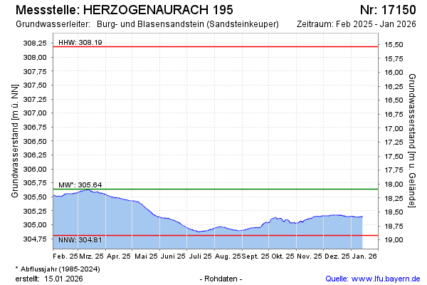
| Date | Groundwater level [m above sealevel] |
|---|---|
| 28.06.2026 | 304.88 |
| 27.06.2026 | 304.88 |
| 26.06.2026 | 304.89 |
| 25.06.2026 | 304.91 |
| 24.06.2026 | 304.92 |
| 23.06.2026 | 304.94 |
| 22.06.2026 | 304.95 |
| 21.06.2026 | 304.96 |