
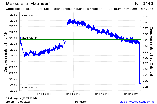
Chart of total period Haundorf
Groundwater level [m above sealevel]: 428,30
Distance to surface [m]: 6,37
Last value from 18.05.2026 08:56
Ground level [m above sealevel]: 434.67
| Date | Groundwater level [m above sealevel] |
|---|---|
| 23.03.2026 | 428.32 |
| 24.02.2026 | 428.25 |
| 17.12.2025 | 426.46 |
| 16.12.2025 | 426.45 |
| 15.12.2025 | 426.45 |
| 14.12.2025 | 426.47 |
| 13.12.2025 | 426.48 |
| 12.12.2025 | 426.51 |