
Current data HALLERNDORF 4
note
keine Tagaktuellen Daten: Datenfernübertragung defekt
Groundwater level [m above sealevel]: 252.97
Distance to surface [m]: 2.28
Last value from 03.06.2026 11:00
Ground level [m above sealevel]: 255.25
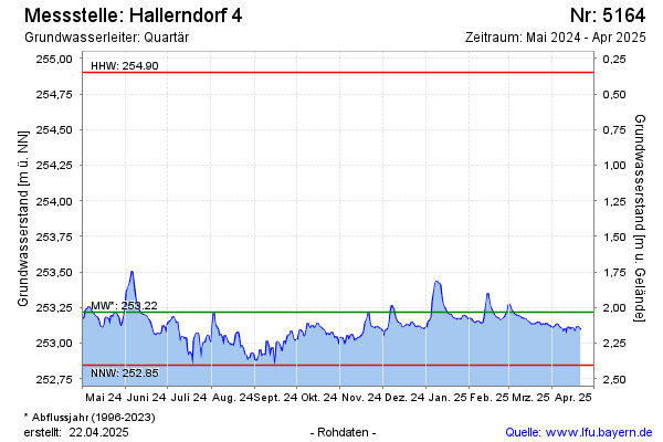
| Date | Groundwater level [m above sealevel] |
|---|---|
| 03.06.2026 | 252.97 |
| 02.06.2026 | 253.05 |
| 01.06.2026 | 253.00 |
| 31.05.2026 | 253.01 |
| 30.05.2026 | 252.99 |
| 29.05.2026 | 252.97 |
| 28.05.2026 | 252.93 |
| 27.05.2026 | 253.01 |