
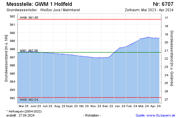
Current data GWM 1 Hollfeld
Groundwater level [m above sealevel]: 386.87
Distance to surface [m]: 21.95
Last value from 13.07.2026 10:00
Ground level [m above sealevel]: 408.82
| Date | Groundwater level [m above sealevel] |
|---|---|
| 13.07.2026 | 386.88 |
| 12.07.2026 | 386.88 |
| 11.07.2026 | 386.88 |
| 10.07.2026 | 386.89 |
| 09.07.2026 | 386.90 |
| 08.07.2026 | 386.90 |
| 07.07.2026 | 386.91 |
| 06.07.2026 | 386.91 |