
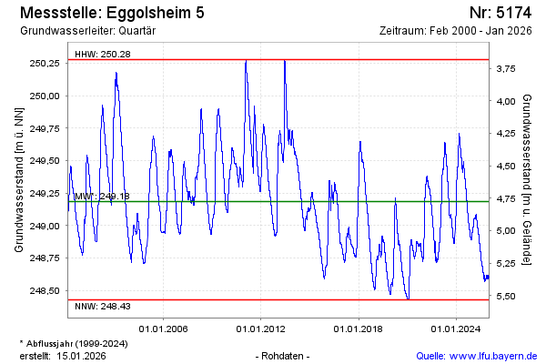
Chart of total period Eggolsheim 5
Groundwater level [m above sealevel]: 248.94
Distance to surface [m]: 5.02
Last value from 14.07.2026 08:39
Ground level [m above sealevel]: 253.96
| Date | Groundwater level [m above sealevel] |
|---|---|
| 14.07.2026 | 248.94 |
| 13.07.2026 | 248.94 |
| 12.07.2026 | 248.95 |
| 11.07.2026 | 248.95 |
| 10.07.2026 | 248.96 |
| 09.07.2026 | 248.96 |
| 08.07.2026 | 248.97 |
| 07.07.2026 | 248.97 |