
- Start >
- Groundwater >
- Waterlevel of upper layer >
- Regnitz >
- Burgoberbach >
- Chart of total period

Chart of total period Burgoberbach
Groundwater levels of the total period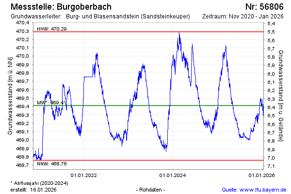
Groundwater level [m above sealevel]: 469.92
Distance to surface [m]: 5.83
Last value from 25.01.2024 14:45
Ground level [m above sealevel]: 475.75
| Date | Groundwater level [m above sealevel] |
|---|---|
| 25.01.2024 | 469.90 |
| 24.01.2024 | 469.89 |
| 23.01.2024 | 469.84 |
| 22.01.2024 | 469.86 |
| 21.01.2024 | 469.81 |
| 20.01.2024 | 469.78 |
| 19.01.2024 | 469.83 |
| 18.01.2024 | 469.96 |
© Bayerisches Landesamt für Umwelt 2024