
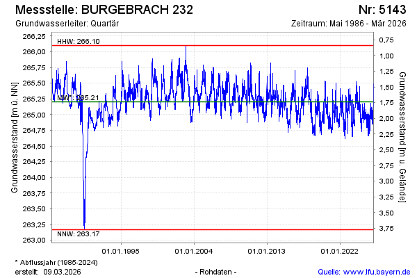
Chart of total period BURGEBRACH 232
Groundwater level [m above sealevel]: 264.76
Distance to surface [m]: 2.18
Last value from 14.07.2026 09:00
Ground level [m above sealevel]: 266.94
| Date | Groundwater level [m above sealevel] |
|---|---|
| 14.07.2026 | 264.71 |
| 13.07.2026 | 264.76 |
| 12.07.2026 | 264.83 |
| 11.07.2026 | 264.77 |
| 10.07.2026 | 264.79 |
| 09.07.2026 | 264.81 |
| 08.07.2026 | 264.82 |
| 07.07.2026 | 264.87 |