
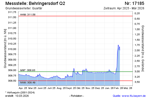
Current data Behringersdorf Q2
Groundwater level [m above sealevel]: 308.72
Distance to surface [m]: 3.22
Last value from 12.05.2026 10:45
Ground level [m above sealevel]: 311.94
| Date | Groundwater level [m above sealevel] |
|---|---|
| 22.06.2026 | 308.63 |
| 21.06.2026 | 308.60 |
| 20.06.2026 | 308.60 |
| 19.06.2026 | 308.61 |
| 18.06.2026 | 308.62 |
| 17.06.2026 | 308.63 |
| 16.06.2026 | 308.63 |
| 15.06.2026 | 308.65 |