
Current data Baiersdorf Q6
Groundwater level [m above sealevel]: 261.98
Distance to surface [m]: 0.94
Last value from 02.07.2026 09:00
Ground level [m above sealevel]: 262.92
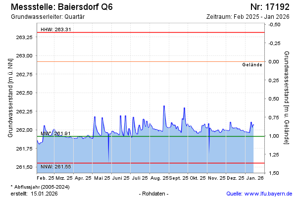
| Date | Groundwater level [m above sealevel] |
|---|---|
| 02.07.2026 | 262.00 |
| 01.07.2026 | 262.01 |
| 30.06.2026 | 262.05 |
| 29.06.2026 | 262.11 |
| 28.06.2026 | 261.98 |
| 27.06.2026 | 261.92 |
| 26.06.2026 | 261.91 |
| 25.06.2026 | 261.92 |