
Chart of total period Ansbach-Orangerie-Mitte
Groundwater level [m above sealevel]: 398,70
Distance to surface [m]: 0,77
Last value from 22.04.2026 13:46
Ground level [m above sealevel]: 399.47
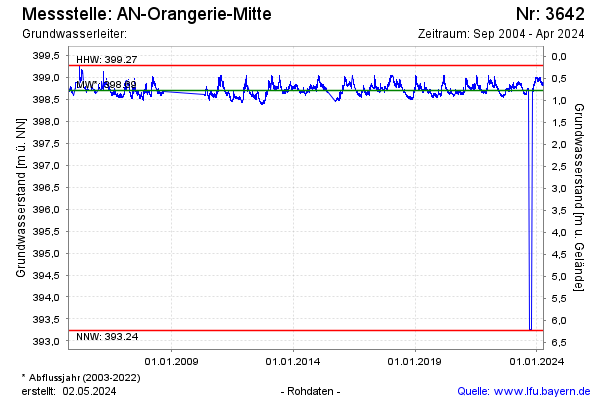
| Date | Groundwater level [m above sealevel] |
|---|---|
| 02.03.2026 | 398.94 |
| 13.11.2025 | 398.77 |
| 20.08.2025 | 398.64 |
| 02.06.2025 | 398.71 |
| 01.06.2025 | 398.72 |
| 31.05.2025 | 398.71 |
| 30.05.2025 | 398.71 |
| 29.05.2025 | 398.70 |