
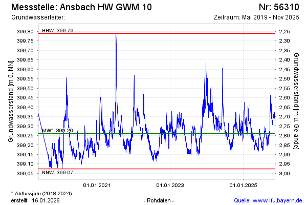
Chart of total period Ansbach HW GWM 10
Groundwater level [m above sealevel]: 399,26
Distance to surface [m]: 2,79
Last value from 22.04.2026 13:23
Ground level [m above sealevel]: 402.05
| Date | Groundwater level [m above sealevel] |
|---|---|
| 22.04.2026 | 399.26 |
| 21.04.2026 | 399.28 |
| 20.04.2026 | 399.29 |
| 19.04.2026 | 399.29 |
| 18.04.2026 | 399.29 |
| 17.04.2026 | 399.28 |
| 16.04.2026 | 399.28 |
| 15.04.2026 | 399.28 |