
- Start >
- Groundwater >
- Waterlevel of upper layer >
- Untere Donau >
- UNTERSBERGWEG L 2 A >
- Year chart of precipitation

Year chart of precipitation UNTERSBERGWEG L 2 A
Groundwater levels of the last 12 months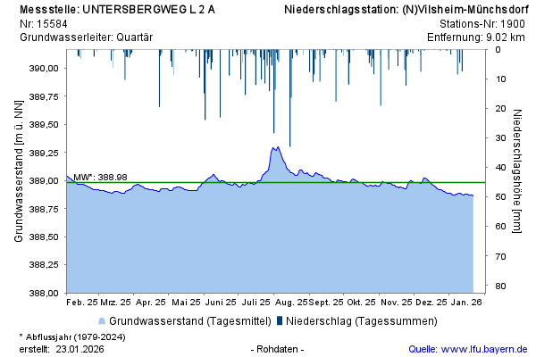
Groundwater level [m above sealevel]: 388,88
Distance to surface [m]: 2,39
Last value from 29.05.2026 10:00
Ground level [m above sealevel]: 391.27
© Bayerisches Landesamt für Umwelt 2026