
- Start >
- Groundwater >
- Waterlevel of upper layer >
- Untere Donau >
- TANNENHOLZ B 75 >
- Chart of total period

Chart of total period TANNENHOLZ B 75
Groundwater levels of the total period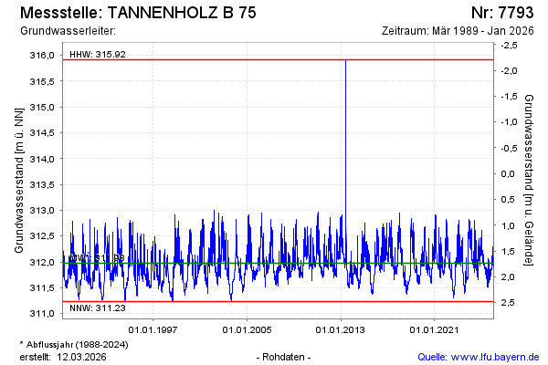
Groundwater level [m above sealevel]: 311.97
Distance to surface [m]: 1.74
Last value from 26.03.2026 10:00
Ground level [m above sealevel]: 313.71
| Date | Groundwater level [m above sealevel] |
|---|---|
| 26.03.2026 | 311.97 |
| 25.03.2026 | 312.00 |
| 24.03.2026 | 311.99 |
| 23.03.2026 | 312.00 |
| 22.03.2026 | 312.02 |
| 21.03.2026 | 312.04 |
| 20.03.2026 | 312.05 |
| 19.03.2026 | 312.06 |
© Bayerisches Landesamt für Umwelt 2026