
- Start >
- Groundwater >
- Waterlevel of upper layer >
- Untere Donau >
- STEINBERG SL-10 >
- Chart of total period

Chart of total period STEINBERG SL-10
Groundwater levels of the total period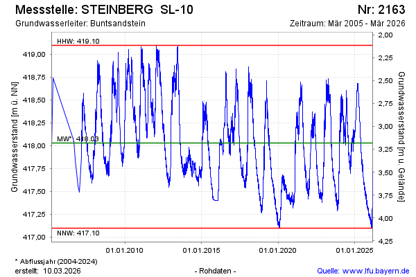
Groundwater level [m above sealevel]: 417.72
Distance to surface [m]: 3.49
Last value from 10.05.2026 04:00
Ground level [m above sealevel]: 421.21
| Date | Groundwater level [m above sealevel] |
|---|---|
| 09.05.2026 | 417.70 |
| 08.05.2026 | 417.71 |
| 07.05.2026 | 417.75 |
| 06.05.2026 | 417.79 |
| 05.05.2026 | 417.81 |
| 04.05.2026 | 417.79 |
| 03.05.2026 | 417.81 |
| 02.05.2026 | 417.76 |
© Bayerisches Landesamt für Umwelt 2026